A strengthening storm system caused destruction across parts of Southern Michigan Tuesday evening. It’s the same system that started near Iowa the day before causing damage from Iowa down to Oklahoma.
The main line of storms developed after 4 pm moving into far SW Lower Michigan. They intensified and became tornadic quickly.
The first tornado warning was issued at 5:14 pm for Van Buren County. The concern was a possible tornado and large hail. About a half hour later, another tornado warning was issued which included Kalamazoo County.
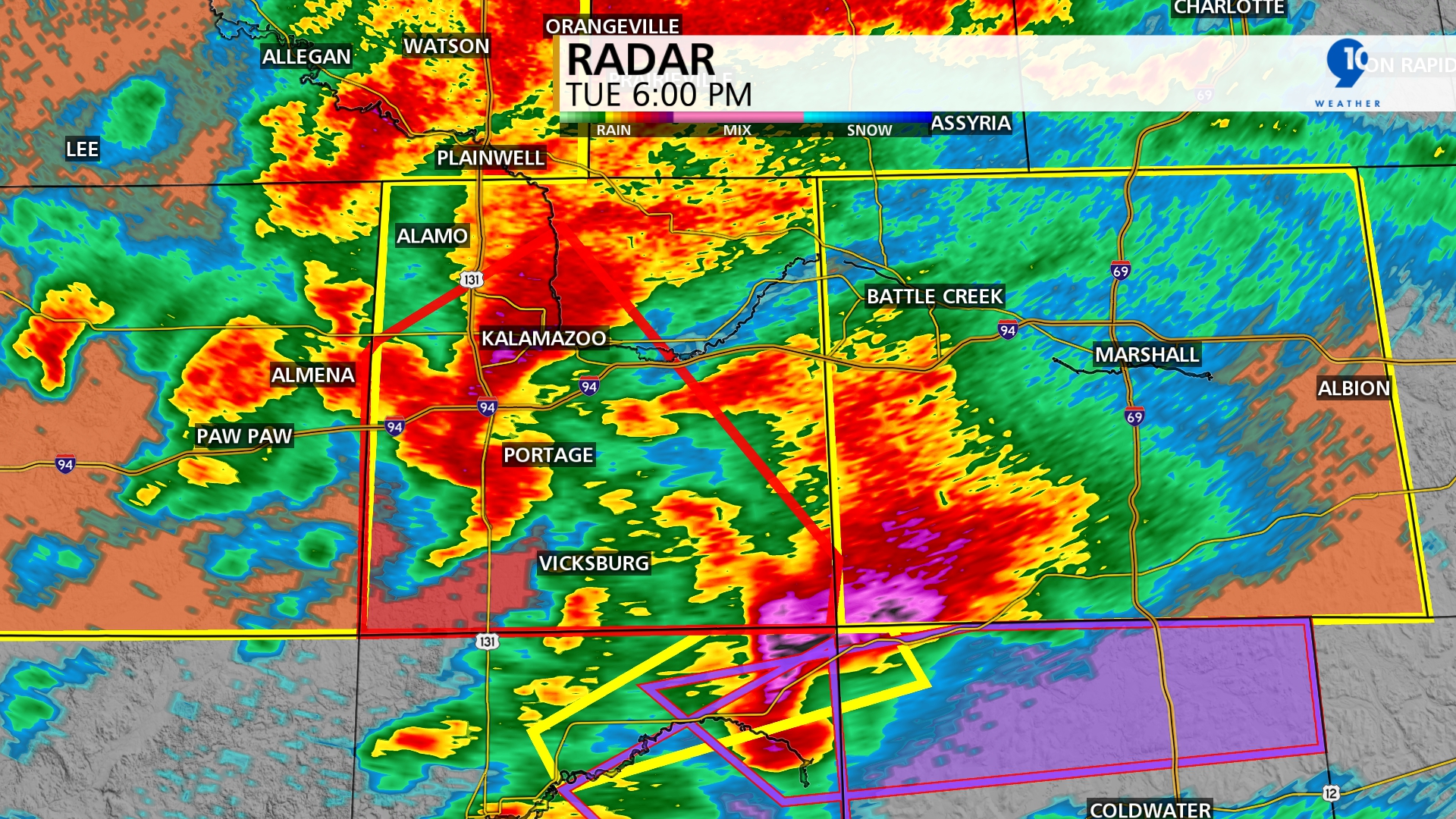
This image shows the storm developing around 6 pm. There were indications of the tornado near Portage and another south of Vicksburg.
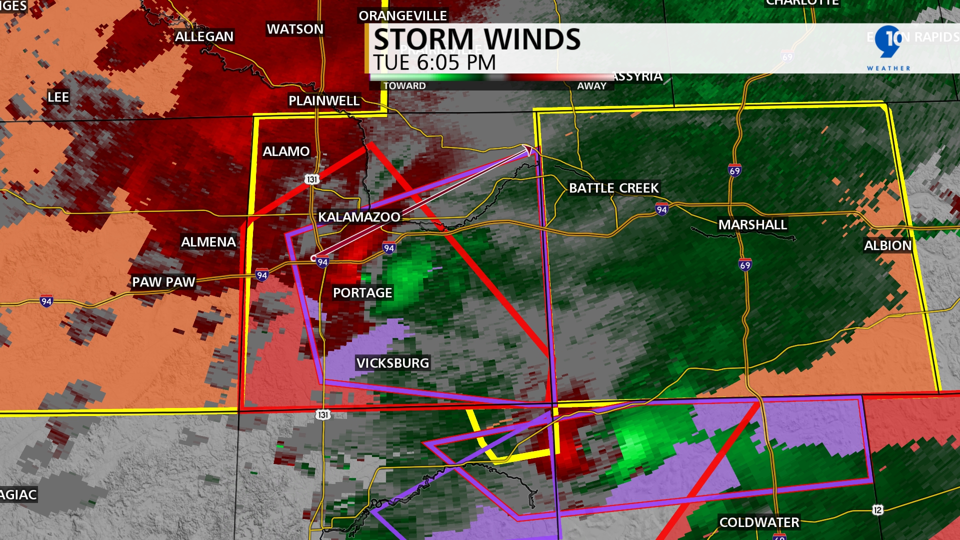
This next image goes inside the storm and shows wind speed and direction, 5 minutes later. The bright colors indicate high winds. When you have bright red and green near each other, it indicates wind rotation.
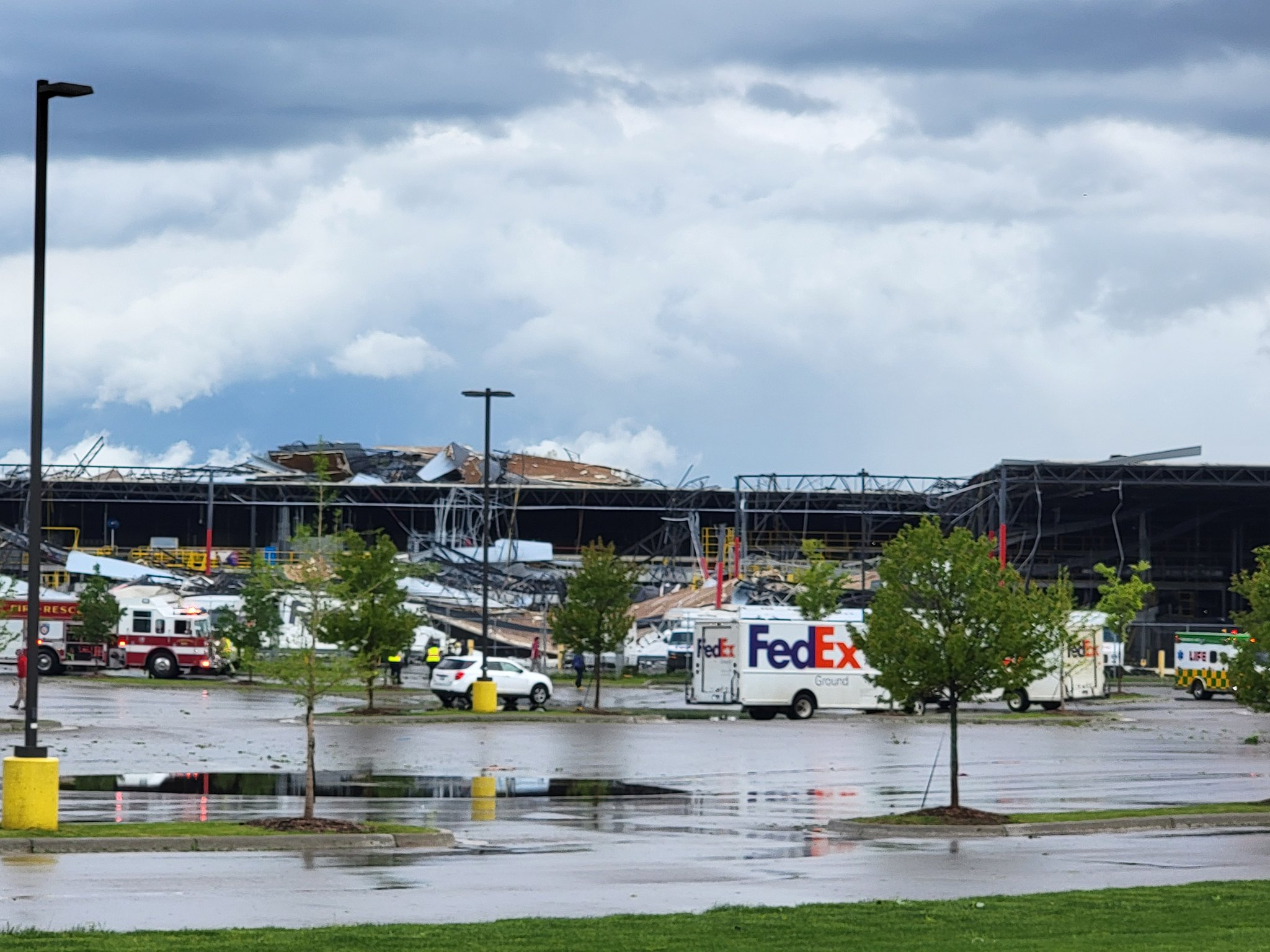
The damage from this storm is incredible. This is a picture of a FedEx Building near Portage, MI taken by Alex Meledez.
Over the course of 2 hours, there were numerous tornado warnings issued for much of Southern Michigan. At one point the designation of a Tornado Emergency was issued for the Centreville to Sherwood tornado. This is the first time for the state of Michigan. Northern Indiana also experienced several tornadoes during this event.
The final details are as follows: 4 tornadoes touched down in Southern Michigan. 1. Portage: EF-2 winds up to 135 mph. 2. SW of Union City: EF-1 with winds up to 95 mph. 3. Dowagiac: EF-1 with winds of 95 mph. The width of this tornado was 950 yards 4. Centreville - Sherwood: EF-2 winds up to 130 mph. The width of this tornado was also 950 yards. 950 yards is just over 1/2 a mile wide. There was one confirmed injury near Colon.


