January in Northern Michigan is usually marked by some of the coldest highs of the year, with temperatures generally only reaching the mid to upper 20s during the daytime hours. Overnight lows are equally cold, with average temperatures usually dipping into the teens, and many locations in the EUP see average lows in the single digits.
It’s normally a gray month as well, with near-constant cloud cover and not much sun to speak of. Don’t let that fool you, though, throughout January the days get noticeably longer! Daylight increases from around 8 hours and 50 minutes at the start of the month to around 9 hours and 45 minutes by the end.
If you enjoy winter sports, January is the month for you - it’s normally packed with plenty of snowfall. Most locations see anywhere from 14-40″ of snowfall throughout January, with classic lake effect spots seeing the higher end of these numbers.
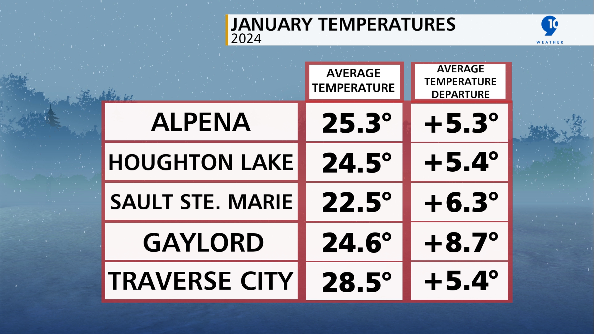
This January took us on a rollercoaster ride of conditions, with the start of the month featuring mostly normal temperatures. The middle of the month brought temperatures 5-15 degrees below normal (Jan. 14-20), and the last two weeks of January ushered in temperatures 10-20 degrees above normal. In the end, it was the warmer temperatures that won this battle. January of 2024 ended up warmer than average and placed in the top 10 warmest Januarys since reliable climate records began for all NWS climate sites.
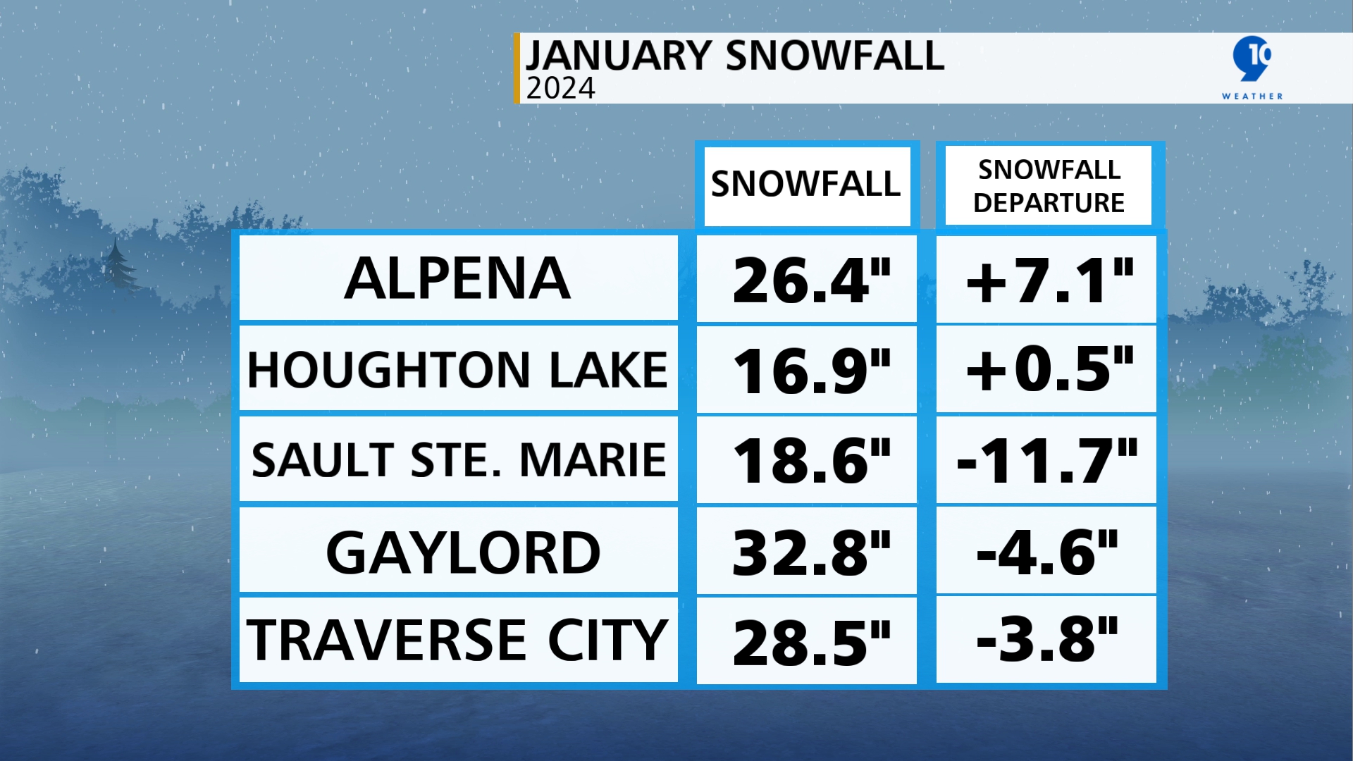
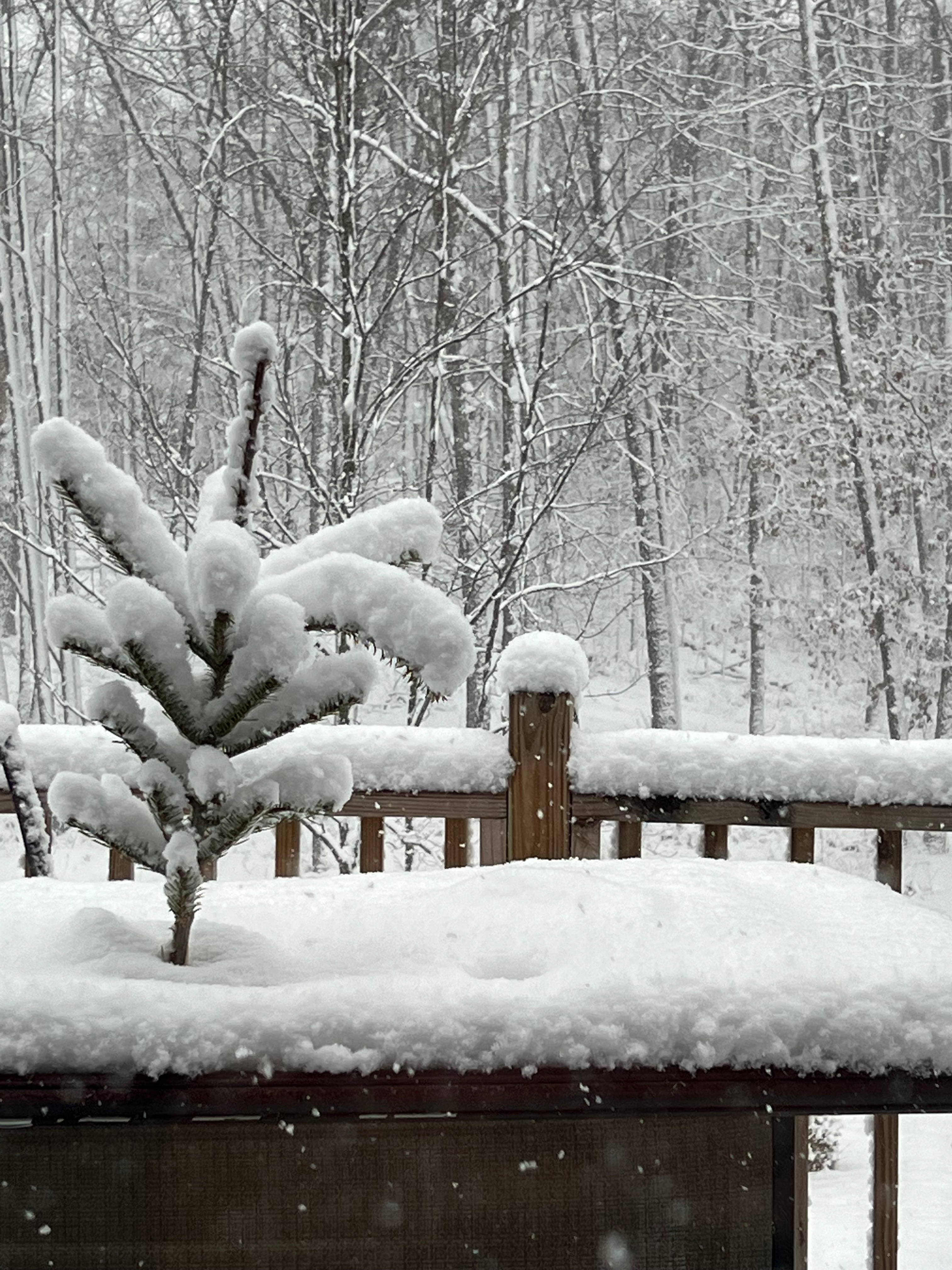
As far as snowfall went, many locations fell below the mark. This is despite the particularly snowy pattern Northern Michigan saw at the start of January. Jan. 9 marked the onset of our first big winter storm of the season. As low pressure swept through the Midwest, many locations saw around 3-6″ fall through the day on the 9th. Directly following the Jan. 9 disturbance, lake effect snow developed and continued to dump on classic snowbelt areas for days afterward, helping to rack up totals in those locations, especially Leelanau, Benzie, and Emmet counties.
In the end, the snowy period we saw between Jan. 9-23 brought as much as 70% of the observed snowfall so far this winter for a few spots.
However, after the 23rd, conditions were dry and warm helping to offset a lot of the snowfall we experienced to start the month and melting a fair amount of the snowpack we had on the ground. This means January 2024 ended up bringing less snowfall than normal for most locations.


